


India’s rivers are much more than lines of water on a map. They have shaped the country’s landscapes, agriculture, cities, trade, religious traditions, wildlife, and travel experiences for thousands of years. From the mighty Ganga and Brahmaputra in the north to the Godavari, Krishna, Narmada, and Cauvery in peninsular India, these rivers connect mountains, plains, forests, farms, wetlands, and coastal regions.
For travelers from the USA and other countries, exploring India’s longest rivers is also a fascinating way to understand the country’s geography. Some rivers pass through major cities and historic sites, while others flow through remote valleys, forests, waterfalls, and pilgrimage destinations. In this guide, you’ll discover the Top 30 Longest Rivers in India, including their approximate lengths, origins, states, destinations, major tributaries, and interesting facts.
Quick Answer:
If you need the answer quickly, these are among the major longest rivers associated with India:
| Rank | River | Approx. Length | Major Region |
| 1 | Indus | ~3,180 km* | North India / Himalayan region |
| 2 | Brahmaputra | ~2,900 km* | Arunachal Pradesh & Assam |
| 3 | Ganga | 2,525 km | North & East India |
| 4 | Godavari | 1,465 km | Central & South India |
| 5 | Krishna | 1,400 km | Western & Southern India |
| 6 | Yamuna | 1,376 km | North India |
| 7 | Narmada | ~1,312–1,333 km | Central India |
| 8 | Ghaghara | 1,080 km | North India |
| 9 | Chambal | 960 km | Central & North India |
| 10 | Gomti | 940 km | Uttar Pradesh |
*The Indus and Brahmaputra are international rivers. Their total courses extend beyond India, so their ranking depends on the definition used.
The CWC lists the Ganga at 2,525 km, Godavari at 1,465 km, Krishna at 1,400 km, Yamuna at 1,376 km, Narmada at 1,312 km, Mahanadi at 851 km, Cauvery at 800 km, and Tapi at 724 km.
Top 30 Longest Rivers in India
Indus River
Approximate total length: 3,180 km
Origin: Tibetan Plateau
Indian region: Ladakh
Outflow: Arabian Sea
River type: International river
The Indus River is one of Asia’s great rivers and gives its name to India. Its overall course begins in the Tibetan Plateau and continues through Ladakh before flowing into Pakistan and eventually reaching the Arabian Sea.
The river is closely connected with the ancient Indus Valley Civilization, one of the world’s earliest urban civilizations.
For travelers, the Indian section around Ladakh is particularly spectacular. High-altitude landscapes, dramatic mountains, monasteries, and wide river valleys create an unforgettable Himalayan setting.
Key Fact
The CWC does not provide a single total length figure for the Indus in the cited basin table because its course extends internationally.
Brahmaputra River
Approximate total length: 2,900 km
Indian states: Arunachal Pradesh, Assam
Origin: Tibetan Himalayas
Major Indian cities/areas: Dibrugarh, Guwahati, Assam Valley
Outflow: Joins the Ganga system in Bangladesh
The Brahmaputra is one of the world’s great Himalayan rivers. It enters India through Arunachal Pradesh and then flows across Assam, where it becomes a defining feature of the landscape.
The river is famous for its enormous width, powerful seasonal flow, fertile floodplains, and important wildlife habitats.
The CWC lists the Brahmaputra at 916 km within the relevant Indian basin table, demonstrating why rankings change when sources measure only a country’s portion rather than the river’s complete international course.
Ganga River
Length: 2,525 km
Origin: Gangotri Glacier region, Uttarakhand
Major states: Uttarakhand, Uttar Pradesh, Bihar, Jharkhand, West Bengal
Outflow: Bay of Bengal
The Ganga is India’s most famous river and one of its most important cultural and geographic features.
India-WRIS gives the Ganga a length of 2,525 km, with its origin associated with the Gangotri glacier region of the Himalayas.
The river flows through or near major cities including Haridwar, Kanpur, Prayagraj, Varanasi, Patna, and Kolkata’s wider river system.
Why Is the Ganga Important?
- Supports agriculture
- Provides water to millions of people
- Has major religious significance
- Supports wetlands and wildlife
- Connects numerous historic cities
- Offers important pilgrimage and travel experiences
Godavari River
Length: 1,465 km
Origin: Maharashtra
Major states: Maharashtra, Telangana, Andhra Pradesh
Outflow: Bay of Bengal
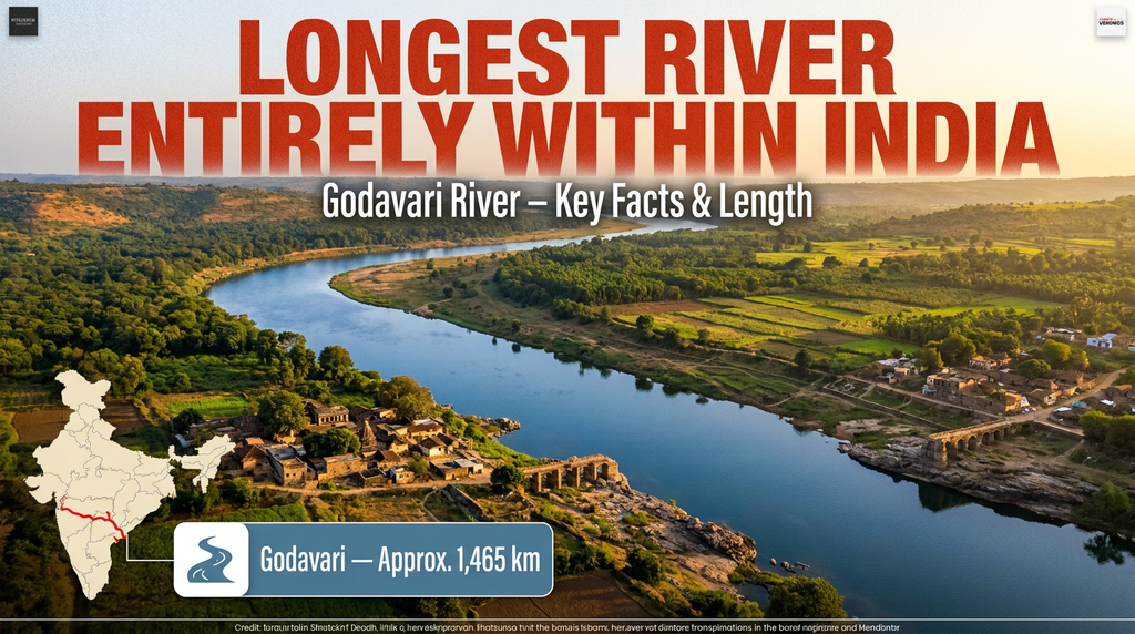
The Godavari is the longest river entirely within India according to the commonly used national ranking and is often called the Dakshin Ganga, or Ganga of the South.
The CWC lists its length as 1,465 km.
It flows eastward across the Deccan Plateau before reaching the Bay of Bengal.
Key Features
The Godavari basin supports agriculture, reservoirs, wetlands, forests, and major settlements.
Krishna River
Length: 1,400 km
Origin: Western Ghats, Maharashtra
Major states: Maharashtra, Karnataka, Telangana, Andhra Pradesh
Outflow: Bay of Bengal
The Krishna River is one of the major rivers of peninsular India.
India-WRIS describes it as an important east-flowing interstate river and gives a total course of about 1,400 km; its GIS-based basin data also reports a slightly different figure of 1,435.07 km, illustrating why river-length numbers can vary by methodology.
Its major tributaries include the Bhima, Tungabhadra, Ghataprabha, and Malaprabha.
Yamuna River
Length: 1,376 km
Origin: Yamunotri Glacier, Uttarakhand
Major states: Uttarakhand, Haryana, Delhi, Uttar Pradesh
Joins: Ganga at Prayagraj
The Yamuna is one of the most important tributaries of the Ganga.
India-WRIS lists its length as 1,376 km and identifies the Yamunotri glacier region as its source.
The river passes near some of India’s most recognizable landmarks, including Delhi and Agra.
Travel Connection
Visitors can combine a Yamuna-focused itinerary with Delhi sightseeing and a visit to the Taj Mahal in Agra.
Narmada River
Length: Approximately 1,312–1,333 km
Origin: Amarkantak, Madhya Pradesh
Major states: Madhya Pradesh, Maharashtra, Gujarat
Outflow: Arabian Sea
The Narmada is India’s most important major west-flowing peninsular river.
The CWC lists it at 1,312 km, while India-WRIS’s Narmada basin report gives 1,333 km using GIS-based calculations.
It flows between the Vindhya and Satpura ranges before entering the Gulf of Khambhat.
Key Fact
Unlike most major peninsular rivers that flow east toward the Bay of Bengal, the Narmada flows west.
Ghaghara River
Approximate length: 1,080 km
Region: Himalayan foothills and northern India
Major areas: Uttar Pradesh and neighboring Himalayan region
Tributary/system: Ganga
The Ghaghara, also known as the Sarju in parts of its course, is one of the major tributaries of the Ganga.
India-WRIS lists its length at approximately 1,080 km.
The river supports fertile agricultural landscapes across northern India.
Chambal River
Length: 960 km
Origin: Vindhya Range near Mhow, Madhya Pradesh
Major states: Madhya Pradesh, Rajasthan, Uttar Pradesh
Tributary: Yamuna
The Chambal River is famous for its dramatic ravines and rich wildlife.
India-WRIS gives the river a length of 960 km.
The Chambal landscape is especially interesting for nature travelers because sections of the river support endangered gharial crocodiles and other wildlife.
Gomti River
Length: 940 km
Origin: Uttar Pradesh
State: Uttar Pradesh
Tributary: Ganga
The Gomti flows through Uttar Pradesh and is closely associated with the city of Lucknow.
India-WRIS lists the river at 940 km.
The river is important for agriculture, urban life, and the historical landscape of the region.
11–20: More of India’s Longest Rivers
| Rank | River | Approx. Length | Major Region |
| 11 | Bhima | 861 km | Maharashtra, Karnataka |
| 12 | Mahanadi | 851 km | Chhattisgarh, Odisha |
| 13 | Cauvery | 800 km | Karnataka, Tamil Nadu |
| 14 | Son | 780 km | Central & East India |
| 15 | Tapi (Tapti) | 724 km | Madhya Pradesh, Maharashtra, Gujarat |
| 16 | Betwa | 789 km | Madhya Pradesh, Uttar Pradesh |
| 17 | Pennar | 597 km | Karnataka, Andhra Pradesh |
| 18 | Damodar | ~575 km | Jharkhand, West Bengal |
| 19 | Mahi | ~538 km | Madhya Pradesh, Rajasthan, Gujarat |
| 20 | Tungabhadra | ~532–552 km | Karnataka, Andhra Pradesh |
The CWC gives Mahanadi as 851 km, Cauvery as 800 km, Tapi as 724 km, and Pennar as 597 km. India-WRIS gives the Bhima at about 861 km and Tungabhadra at about 552 km in its Krishna basin GIS table.
Bhima River
The Bhima River is a major tributary of the Krishna and flows through Maharashtra and Karnataka.
India-WRIS’s Krishna basin data gives the Bhima a length of approximately 861 km.
Mahanadi River
Length: 851 km
Major states: Chhattisgarh, Odisha
Outflow: Bay of Bengal
The Mahanadi is one of eastern India’s major rivers. It supports agriculture, reservoirs, wetlands, and important ecosystems before reaching the Bay of Bengal.
The CWC lists the Mahanadi at 851 km.
Cauvery River
Length: 800 km
Origin: Karnataka
Major states: Karnataka, Tamil Nadu
Outflow: Bay of Bengal
The Cauvery, also spelled Kaveri, is one of southern India’s most culturally and economically important rivers.
The CWC lists its length at 800 km.
Its landscapes include forests, waterfalls, temples, farmland, and historic towns.
Son River
Length: 780 km
Origin: Madhya Pradesh
Major region: Central and eastern India
Tributary: Ganga
The Son River flows through central and eastern India before joining the Ganga system.
India-WRIS lists the Son at 780 km.
Tapi River
Length: 724 km
Origin: Madhya Pradesh
Major states: Madhya Pradesh, Maharashtra, Gujarat
Outflow: Arabian Sea
The Tapi, or Tapti, is another major west-flowing river.
The CWC lists its length at 724 km.
It runs broadly parallel to the Narmada before reaching the Arabian Sea.
Betwa River
Length: 789 km
Major states: Madhya Pradesh, Uttar Pradesh
Tributary: Yamuna
The Betwa is an important river of central India and joins the Yamuna.
India-WRIS gives its length as 789 km.
It is closely associated with the historic region of Bundelkhand.
Pennar River
Length: 597 km
Origin: Karnataka
Major state: Andhra Pradesh
Outflow: Bay of Bengal
The Pennar, also known as Penna, is an important river of southern India.
The CWC lists it at 597 km.
Damodar River
Approximate length: 575 km
Region: Jharkhand and West Bengal
Outflow: Hooghly/Ganga system
The Damodar is historically important in eastern India and was once associated with severe flooding, earning a famous nickname connected to its floods.
India-WRIS gives the Damodar a length of 575 km in its Ganga basin table.
Mahi River
Approximate length: 538 km
Origin: Madhya Pradesh
Major states: Madhya Pradesh, Rajasthan, Gujarat
Outflow: Arabian Sea
The Mahi is one of western India’s notable rivers.
The CWC lists its length at 538 km and identifies the Arabian Sea as its drainage destination.
Tungabhadra River
Approximate length: 532–552 km
Major states: Karnataka, Andhra Pradesh
Tributary: Krishna
The Tungabhadra is formed by the Tunga and Bhadra rivers and eventually joins the Krishna.
India-WRIS’s Krishna basin report gives a GIS-based length of approximately 551.56 km.
The river is especially important around the historic Hampi region.
21–30: Other Important Long Rivers in India
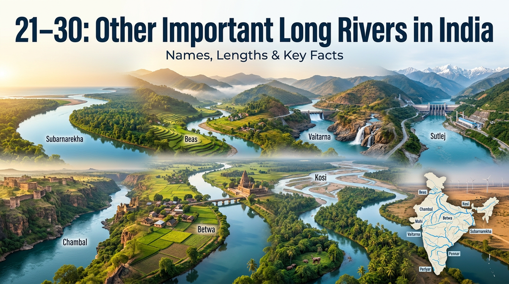
| Rank | River | Approx. Length | Major Region |
| 21 | Luni | ~495 km | Rajasthan |
| 22 | Subarnarekha | 395 km | Jharkhand, West Bengal, Odisha |
| 23 | Sabarmati | 371 km | Rajasthan, Gujarat |
| 24 | Baitarani | ~360 km | Odisha |
| 25 | Palar | ~348 km | Karnataka, Andhra Pradesh, Tamil Nadu |
| 26 | Ken | 357 km | Madhya Pradesh, Uttar Pradesh |
| 27 | Brahmani | ~799 km* | Odisha/Jharkhand system |
| 28 | Teesta | ~414 km* | Sikkim, West Bengal & Bangladesh |
| 29 | Tunga | ~147 km | Karnataka |
| 30 | Bhadra | ~178 km | Karnataka |
*Some rivers, particularly systems formed by multiple branches or international courses, can have substantially different reported lengths depending on methodology. The table should therefore be treated as a practical travel/geography ranking rather than a universal scientific ranking.
Luni River
The Luni is one of the most important rivers of Rajasthan.
It flows through the dry landscape of western India and eventually loses much of its flow in the Rann of Kutch region rather than reaching the open sea as a conventional perennial river.
Travel Interest
The Luni region offers a very different river experience from the lush Himalayan and southern rivers.
Subarnarekha River
Length: 395 km
Major states: Jharkhand, West Bengal, Odisha
Outflow: Bay of Bengal
The Subarnarekha, meaning “streak of gold,” flows through eastern India.
The CWC lists it at 395 km.
Sabarmati River
Length: 371 km
Major states: Rajasthan, Gujarat
Outflow: Arabian Sea
The Sabarmati is particularly associated with Ahmedabad, where the riverfront has become an important urban attraction.
The CWC lists the Sabarmati at 371 km.
Baitarani River
The Baitarani is an important river of Odisha and forms part of the state’s extensive river network.
Its basin is strongly connected with agriculture, wetlands, coastal ecosystems, and local communities.
Palar River
The Palar flows through southern India and reaches the Bay of Bengal.
Its course is strongly seasonal in many areas, reflecting the monsoon-driven nature of several peninsular Indian rivers.
Ken River
Length: 357 km
Region: Madhya Pradesh and Uttar Pradesh
India-WRIS lists the Ken at 357 km.
The Ken is particularly important for the natural landscapes of Bundelkhand.
Brahmani River
The Brahmani is a major river system in eastern India, especially important in Odisha and Jharkhand.
Its reported length varies depending on whether measurements include its constituent streams and the system’s full course.
Teesta River
The Teesta rises in the Himalayan region and flows through Sikkim and West Bengal before continuing into Bangladesh.
It is known for its dramatic mountain scenery, rapids, valleys, and adventure-tourism opportunities.
Tunga River
The Tunga is a relatively short but important river of Karnataka. It eventually joins the Bhadra to form the Tungabhadra.
Its origin in the Western Ghats makes the river’s surroundings especially green and scenic.
Bhadra River
The Bhadra is another important Western Ghats river of Karnataka.
It joins the Tunga to form the Tungabhadra, one of the major tributaries of the Krishna.
Longest Rivers in India by Major River System
India’s rivers can also be understood through their drainage systems.
| River System | Major Rivers |
| Ganga System | Ganga, Yamuna, Ghaghara, Chambal, Gomti, Son, Betwa |
| Brahmaputra System | Brahmaputra, Teesta and tributaries |
| Godavari System | Godavari and major peninsular tributaries |
| Krishna System | Krishna, Bhima, Tungabhadra |
| Narmada System | Narmada and its tributaries |
| Mahanadi System | Mahanadi and eastern tributaries |
| Cauvery System | Cauvery and southern tributaries |
| Indus System | Indus and Himalayan tributaries |
This river-system approach is often more useful than looking at length alone because a river’s importance also depends on its basin size, water flow, tributaries, agriculture, cities, biodiversity, and cultural importance.
Which Is the Longest River Entirely Within India?
A common question is:
“Which is the longest river in India?”
The answer depends on the definition.
If you include international rivers by their entire course, the Indus and Brahmaputra are longer than the Ganga, but much of their courses lie outside India.
If you mean the longest major river whose course is entirely within India, the Godavari is commonly identified as the longest, at approximately 1,465 km according to the CWC.
This distinction is important when comparing river rankings.
East-Flowing vs West-Flowing Rivers
One of the easiest ways to understand India’s geography is to divide major rivers by where they drain.
East-Flowing Rivers
Most major peninsular rivers flow east toward the Bay of Bengal.
Examples include:
- Godavari
- Krishna
- Mahanadi
- Cauvery
- Pennar
- Subarnarekha
West-Flowing Rivers
Several important rivers flow west toward the Arabian Sea.
Examples include:
- Narmada
- Tapi
- Mahi
- Sabarmati
The Narmada is particularly notable because it is described by India-WRIS as the largest west-flowing river of peninsular India.
Why Are India’s Rivers Important?
India’s rivers support many parts of everyday life.
Agriculture
River systems provide water for irrigation and support some of India’s most productive agricultural regions.
Drinking Water
Large populations depend directly or indirectly on river systems for water.
Hydropower
Several major rivers support dams and hydroelectric projects.
Wildlife
River ecosystems provide habitats for fish, birds, turtles, gharials, dolphins, and other species.
Culture and Religion
Rivers such as the Ganga, Yamuna, Narmada, and Cauvery have deep cultural and religious importance.
Tourism
Rivers create opportunities for:
- Boat rides
- Rafting
- Wildlife tours
- Photography
- Heritage tourism
- Pilgrimage
- Scenic road trips
- Nature travel
Best Rivers in India for Travelers
If you’re planning an India trip, different rivers offer different experiences.
| River | Best Travel Experience |
| Ganga | Spiritual and cultural tourism |
| Brahmaputra | Wildlife and Assam landscapes |
| Indus | Himalayan scenery |
| Yamuna | Delhi and Agra heritage |
| Godavari | South Indian culture |
| Krishna | Deccan landscapes |
| Narmada | Central India nature |
| Chambal | Wildlife |
| Cauvery | Waterfalls and temples |
| Teesta | Mountain adventure |
| Tungabhadra | Hampi heritage |
| Sabarmati | Ahmedabad city tourism |
Pros and Cons of Visiting India’s Major Rivers
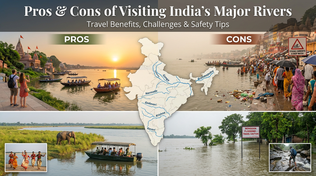
| Pros | Cons |
| Incredible landscapes | Monsoon flooding can affect travel |
| Rich cultural experiences | Some rivers have pollution issues |
| Wildlife opportunities | Water conditions vary seasonally |
| Historic cities nearby | Remote areas may have limited facilities |
| Photography opportunities | Weather can change quickly |
| Adventure activities | Some activities require permits or guides |
| Diverse regional experiences | Travel distances can be long |
Expert Tips for Exploring India’s Rivers
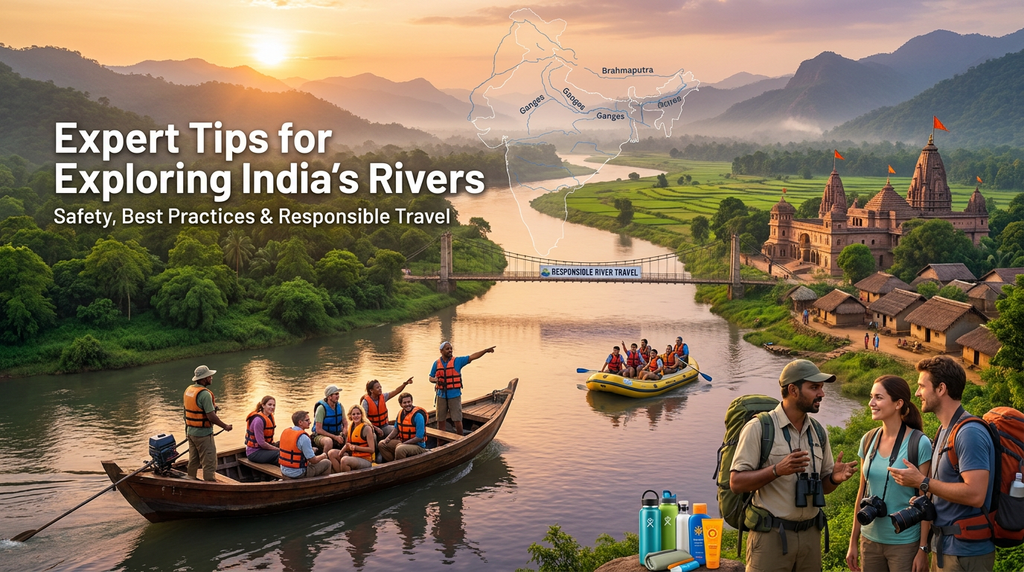
Check the Season
River experiences can change dramatically between the dry and monsoon seasons.
Choose the Right Region
Don’t try to visit multiple distant rivers on one short trip. India is enormous, and river basins can cover several states.
Use Local Guides
For rafting, wildlife tours, trekking, and remote river areas, use reputable local operators.
Respect Religious Sites
Some rivers have important religious significance. Dress appropriately and follow local customs when visiting temples and ghats.
Protect the River
Avoid throwing plastic, food packaging, or other waste into rivers.
Check Weather Warnings
Mountain rivers can rise quickly after heavy rain.
Verify River Conditions
For adventure activities such as rafting or boating, check local safety conditions before departure.
Don’t Assume Every River Is Safe for Swimming
Water quality, currents, wildlife, and seasonal conditions vary considerably.
Common Mistakes When Researching India’s Longest Rivers
Treating Every Ranking as Identical
Different organizations may use different measurement methods.
Ignoring International Rivers
The Indus and Brahmaputra extend beyond India’s borders.
Confusing a River With Its Basin
A river’s basin can be much larger than the river itself.
Mixing Tributaries With Main Rivers
For example, the Tungabhadra is a tributary of the Krishna, while the Tunga and Bhadra form the Tungabhadra.
Assuming River Length Never Changes
Measurements can vary because of mapping methods, source definitions, and whether tributary headwaters are included.
Using Outdated Numbers Without Attribution
For a trustworthy article, identify the organization or methodology behind the number whenever possible.
Longest Rivers in India Checklist
Before publishing or using a river ranking, check:
- River name is correct
- Length is clearly identified as approximate where necessary
- International rivers are clearly marked
- Origin is included
- Major states are included
- Drainage destination is mentioned
- Tributaries are not confused with main rivers
- Data source is identified
- Photos have accurate captions
- Image alt text is descriptive
- Travel advice is seasonally appropriate
FAQs
Which is the longest river in India?
The answer depends on the definition. The Ganga is 2,525 km long according to India-WRIS, while the Indus and Brahmaputra have longer total international courses. The Godavari, at 1,465 km, is commonly regarded as the longest river entirely within India.
Which is the longest river entirely in India?
The Godavari is generally considered the longest major river entirely within India, with a CWC-listed length of 1,465 km.
What are the top 5 longest rivers associated with India?
Depending on whether international rivers are ranked by their full course, the top group includes the Indus, Brahmaputra, Ganga, Godavari, and Krishna.
Which is the longest river in South India?
The Godavari is the longest river associated with peninsular/southern India and is often called the “Dakshin Ganga.”
Which river is the longest west-flowing river in India?
The Narmada is the largest west-flowing river of peninsular India. India-WRIS gives its GIS-based length as about 1,333 km, while the CWC table gives 1,312 km.
Which river flows through Delhi?
The Yamuna River flows through Delhi and is one of the Ganga’s major tributaries.
Which river flows through Assam?
The Brahmaputra is the major river flowing through Assam.
Which is India’s longest river that flows into the Arabian Sea?
The Narmada is the major longest west-flowing peninsular river draining into the Arabian Sea.
Which river is famous near Hampi?
The Tungabhadra River flows through the historic Hampi region of Karnataka.
Why do river-length rankings differ?
Rankings differ because organizations may measure the river from different source points, use different mapping methods, include or exclude tributary headwaters, or measure only the portion within a particular country.
Conclusion
India’s rivers tell the story of the country’s geography, culture, agriculture, wildlife, and history. The Top 30 Longest Rivers in India include enormous Himalayan and international rivers such as the Indus, Brahmaputra, and Ganga, as well as major Indian rivers such as the Godavari, Krishna, Narmada, Yamuna, Mahanadi, and Cauvery.
For travelers, these rivers offer far more than impressive numbers. They lead to Varanasi’s ghats, Assam’s wildlife, Ladakh’s mountains, Hampi’s ruins, Rajasthan’s desert landscapes, Gujarat’s riverfronts, and the lush Western Ghats.
If you are planning an India trip, consider adding a river destination to your itinerary. Choose the region based on the experience you want culture, wildlife, adventure, photography, history, or nature—and always check seasonal weather and local safety information before traveling.
For accuracy, remember that river rankings can vary by measurement method. When publishing this article, keep the stated source and methodology alongside important length figures rather than presenting every number as an absolute value.
Read More:Where to Find the Best Avocado Toast in London: 7 Affordable Spots From East to West
